French Creek Scenic Drive
From the Payette National Forest
Here's what you will see while driving the French Creek Loop:
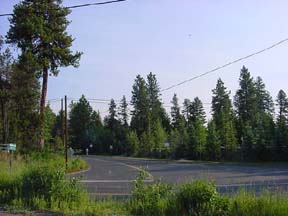
(Mile 00) To begin your trip, turn on to the Warren Wagon Road off Hwy 55 near the Shore Lodge (Whitetail Resort for you newcomers) in McCall. In the 1800's this road was a pack trail to the mining country near Warren. It later became a wagon road and some of the old ruts and creek fords can still be seen in the forest parallel to the highway.
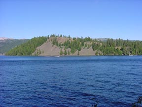
(Mile 3.9) You are now driving through the Narrows of Big Payette Lake, the thinnest part of the lake. That's Ponderosa Sate Park just across Payette Lake.

(Mile 6.3) This is North Beach State Park. Stop and hike along the beach, take a swim or camp. There's a restroom and picnic area. The North Fork of the Payette River empties into Payette Lake here.

(Mile 9.4) The road crosses Fisher Creek that flows into the North Fork of the Payette. In September, Kokanee Salmon from Payette Lake migrate up the creek. It's a good place to see the fish in bright red spawning colors.

(Mile 13.1) You are still travelling along the scenic North Fork of the Payette though thick forests of pine, fir, spruce, aspen and tamarack trees tangled among outcroppings of granite.

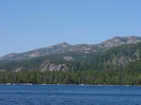
(Mile 14.9) The beautiful mountain lake to the left is Upper Payette Lake. Here you'll find plenty of campsites. It is also a good spot to cast a line!


(Mile 21.9) Just about now you should be topping Secesh Summit. Notice the sign warning hunters to be aware of moose. Maybe you will be lucky and see a moose!
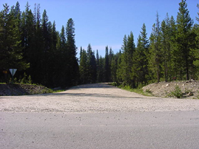
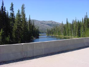
(Mile 27.3) Slow down. You have to make a left turn on to Forest Road 246, just across the Lake Creek Bridge. See the sign pointing to Riggins. Look at the nice campsites along the stream and appreciate the road as it turns to gravel from this point on.


(Mile 29) Burgdorf Hot Springs, which is on the National Register of Historic places, is on the right. This was also a rest stop for freight haulers. Fred Burgdorf, a German immigrant who came to the Idaho mining country, developed the hotsprings. Just up the road is a public campground.
(Mile 32.3) On the right is a logging operation. Notice the piles of logs and debris known as slash piles.
(Mile 36.1) Imagine driving freight wagons over this road as it climbs and winds through the Forest!
(Mile 37.7) You are on the top and starting downhill into Salmon River country. Notice the road way down below you. Yes, it is the same road you are on now! Look at those hairpin turns!
(Mile 39.4) This area looks devastated. Read the Forest service sign entitled,"Destruction and REsurrection". It explains how the Forest is coming back after the 1985 French Creek fire in which 15,000 acres of valuable timber, watershed and wildlife habitat were burned. But now life is rising from the ashes. New green plants and wildlife have returned. From here the road continues out on open slopes and into lush pockets of vegetation.
(Mile 42.1) On the left is the Edmondson pioneer cabin. It was a freight stop on the French Creek Road that was considered a shortcut from the Salmon River to Warren and McCall. A man named Edmundson built the cabin in 1900 and stayed there with his family until 1930.
(Mile 46.4) The road is full of curves. It is hard to imagine how this road could have been considered a State Highway at the turn of the century.
(Mile 51.9) Here's French Creek with its cool and clear waters tumbling downward over rocks toward the Salmon River. If you've got the time, drop a fishing line. The creek was named after French miners.
(Mile 53.6) You are now at the intersection of the French Creek and Salmon River Roads. A bridge was built here in the late 1800's, crossing the Salmon River to connect the main north-south state highway with Florence. The bridge blew down in 1901, according to "Idaho for the Curious" by Cort Conley. Turn left and head downriver. There are scenic views of the canyon, river and beaches at every bend in the road. While travelling this road, monitor CB Channel 1 for logging traffic. The beaches along the way are great for sunbathing or swimming. Remember to wear a lifejacket. The Salmon River can be dangerous.
(Mile 58.3) The narrow steel bridge coming up is the Manning Bridge, which was built by the Civilian Conservation Corps in the 1930's. The canyon downstream is called the Cervice, a site where the Army corps of Engineers planned a dam. The bridge looks pretty shaky but don't worry! It is only one lane so make sure there are no cars coming from the other direction.
(Mile 61.5) The Spring Bar Campground is a nice place to stop and camp or take a rest. Restrooms and picnic tables are available. This is the main take-out point for rafters floating the Salmon River.
(Mile 62.2) The Allison creek picnic area is another good spot for a picnic. You are getting into drier, hotter terrain with more open hillsides and fewer trees.
(Mile 71.5) Ahead of you is Highway 95. No more dirt! Just pavement. Turn right to Riggins if you need gasoline or a snack. To continue the journey, turn left towards McCall.
(Mile 74.7) You are now following the Little Salmon River, a major salmon and steelhead spawning stream. The turnoff to the right goes to Rapid River Hatchery where salmon are raised. The hatchery, operated by Idaho Power and Idaho Fish and Game, is open to visitors from 8 am to 5 pm.
(Mile 93.5) Notice the waterfall on the Little Salmon River. Salmon and steelhead cannot get upstream past this obstruction.
(Mile 99.9) By now you are weary and your muscles are sore. Zim's Hot Springs to the right is a good spot to soak. Just down the road is an intersection at New Meadows. Turn left on Highway 55 and head for McCall.
(Mile 104.2) To the left is Packer John's Cabin State Park, another piece of history. The park offers primitive camping. John Welsh packed supplies to mining camps in the 1860's. He built a cabin in this spot to use as a stopover. The cabin has been rebuilt.
(Mile 114.7) You are back at the starting point in McCall, just in time for dinner after a journey into Idaho's backcountry.